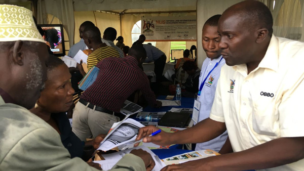
Between 2010 and 2014 IGN FI (www.IGNFI.com) carried out the design, supply and installation of a Land Information System (LIS) for 6 decentralised offices of the Ugandan ministry responsible for land administration affairs, and at the same time created a National Land Information Centre.
In 2015 the World Bank selected IGN FI to roll out an efficient, reliable and transparent Land Information System nationally. The two phases involved in total:
- Roll-out in 22 districts,
- More than 800,000 property titles scanned and then indexed,
- More than 90,000 existing paper maps restored, scanned and then geo-referenced,
- Approximately 800,000 parcels vectorised on the bases of these cadastral maps,
- Over 500 people receiving training in using the new tools and procedures.
Today, 10 years after the initial launch of the project, the system is fully operational in Uganda. It is now possible to quantify the return on investment for the Ugandan government:
- Increase in the number of property titles issued
- Implementation of a decentralised system, closer to the people,
- Reduced number of disputes coming before the courts
- Shortened, standardised procedures,
- Increased productivity of administrative teams
- Reduction in losses of documents and risks of fraud.
To mark the conclusion of the DESINLISI project, the Ugandan Ministry in charge of land administration affairs is holding an international conference on the theme of “Global Modernisation of Land Administration - Making your LIS a Success”.
This event will take place on 20 and 21 February 2020 in Entebbe.
Almost 200 participants from about 30 countries are expected to attend.
Over the course of the two-day seminar the experts involved in the project will present the principal outcomes.
Representatives from a number of different countries which have also set up a LIS or who are interested in establishing such a tool will also be sharing their experiences.
Distributed by APO Group on behalf of IGN FI.Media Contact:
Aude Areste Lamendour
+33 6 81 76 91 23 / +225 87 66 49 79
About IGN FI:
IGN FI (www.IGNFI.com) is one of the companies in the GEOFIT (http://bit.ly/2HDFxgQ) group, and as international technical operator for IGN France (http://bit.ly/2HHySlv), is a major player in the field of geomatics. It applies its technical expertise (in geodesy, metrology, cartography, infrastructure for national geographic data, databases, geographic information systems, portals) to many sectors of activity including agriculture, forests, the environment, civil security, borders etc).
100% devoted to export, IGN FI has carried out numerous land administration projects in Africa (Uganda (http://bit.ly/2V4q4hu), Tanzania (http://bit.ly/2V4DhqU), Ethiopia (http://bit.ly/2V3OCaE), Senegal (http://bit.ly/39JkTYz)) and in Latin America (Trinidad and Tobago (http://bit.ly/2SWjtD9), Ecuador (http://bit.ly/39LbsYz)).
IGN FI has recently been appointed by Ivory Coast to modernise its land administration and set up an LIS. The project will begin in March 2020 and is expected to be completed two year later.
www.IGNFI.com
